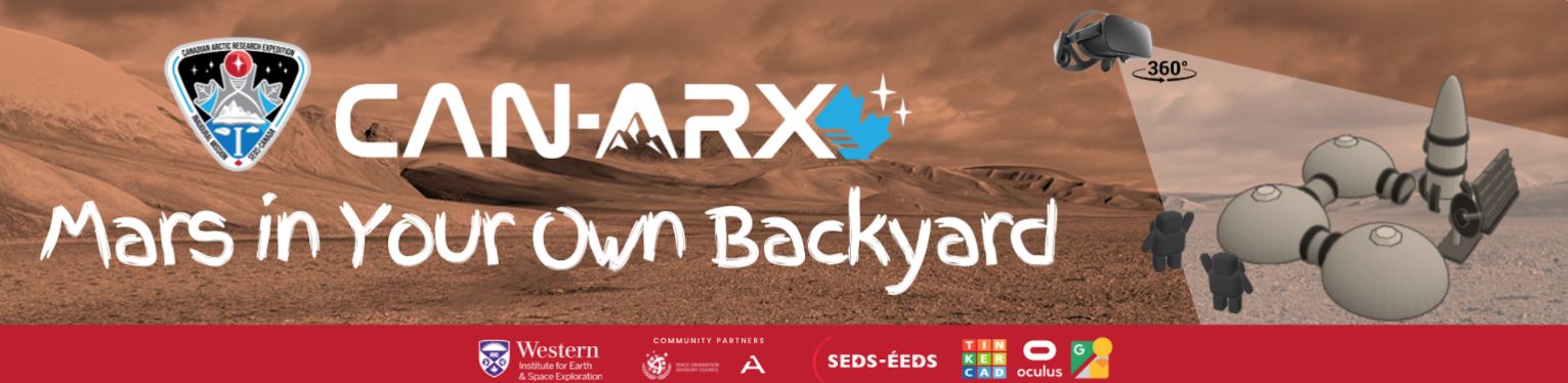
Mars In Your Own Backyard — Part I
Make use of the Google Street View Smartphone App to take 360° images of different parts of the Arctic!

This activity is open to the public. Participation from families, post-secondary students, student teams, students (K-12) and indigenous participants are highly encouraged!
Through this activity, people can share, increase visibility of Arctic sites, and contribute to data monitoring and collection programs in the Canadian High Arctic for the benefit of Science, Technology, Engineering, Arts, and mathematics (STEAM) education in the North. Learn about:
- 3D Design
- 360° Images
- Virtual Reality (VR)
- Arctic environment
Instructions: Are you VR ready?
Step 1: Google Street View App Specifications
- Download Google Street View app from the App Store/Google Play/etc.
- PREREQUISITE: An Apple ID account or a Google Android account.
- Link to download Google Street View app (iOS Apple)
- Link to Google Street View app (Android)
- In the app:
- NOTE: A Google account is recommended to upload 360 images using the app.
- No Google account? No problem! To submit your 360 image without a Google account, please send us your 360 images (e.g. a link via Dropbox or OneDrive) along with the exact coordinates where the image was taken. CAN-ARX staff will post the image on your behalf.
Step 2: How to take your first 360° image
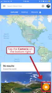
- Open the Street View App
- Tap the Camera on the bottom right
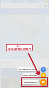
- Tap Take photo sphere
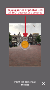
- Take a series of photos until all 360 degrees are covered, or press the checkmark.
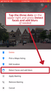
- Tap the three dots on the upper right and press “Detect faces and add blurs” (if needed)
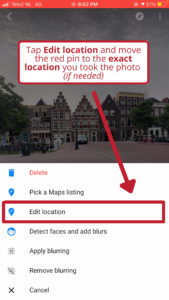
- Tap “Edit location” and move the red pin to the exact location you took the photo.
- Your 360 photos will be stitched together and saved in the “Private” tab. The photo is saved on your phone as well unless you have the setting turned off.
NOTE: Please ensure that your photos do not include people’s faces, addresses, and/or personal information. Alternatively, you may use the blurring tool.
Step 3: How to publish & submit your 360° image
- Under Explore:
- Drag map around to survey Arctic sites
- Some sites already have 360 images
- Under Profile:
- Sign-in!
3. To submit your 360 image to CAN-ARX
- Select “Submit your photos” below!
- Fill out the Google form
Check out this example from Resolute Bay, Nunavut!
Step 4: How to view your photos in VR & Other Resources
If you are interested in taking it further, please check these resources below for creating an object and placing and viewing in VR overlain on your own, personal 360 images! SEDS-Canada will pick some highly commended pictures and will use this as the background for 3D designs & creations using an Oculus VR headset demonstration (more details to be announced).
- Create something in VRChat virtual world builder (https://hello.vrchat.com/)
- View your creation using VR (or use your own headset, if you have one!): https://arvr.google.com/cardboard/
- How to take 360 pictures with Google Street View (https://www.youtube.com/watch?v=ZyxWK5JTykY)


 Associate Professor